Research
Research on mass wasting, environmental seismology, planetary landscapes, remote sensing, and sediment transport on Earth and across the Solar System.
Landscapes in motion, from Earth to other worlds
I investigate how surface and near-surface environments evolve when gravity, climate, fluids, and sediment transport act under very different planetary conditions. Earth, Mars, Titan, Venus, the Moon, and icy satellites provide complementary natural laboratories for identifying which mechanisms are universal and which depend on a particular atmosphere, gravity field, climate, or surface material.
My approach combines remote sensing, field observations, image processing, environmental seismology, and physics-based numerical modeling. I use these methods both to understand planetary landscapes and to improve the observation and modeling of hydro-gravitational hazards on Earth.
Research themes
Mass wasting and hydro-gravitational hazards
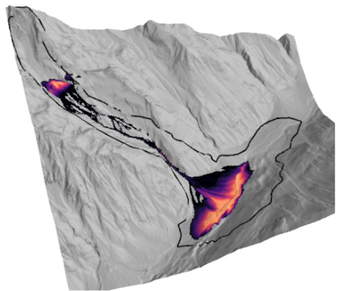
Landslides, rock avalanches, debris flows, and landslide-generated tsunamis transfer large volumes of material over short timescales. I study how failure geometry, basal friction, dynamic weakening, erosion, and topography control their mobility and deposits.
This work links field and satellite observations to depth-averaged flow models such as SHALTOP, force-history inversion, and probabilistic surrogate models. Applications range from Alpine and tropical catchments to giant landslides on Mars and icy satellites.
- Initiation, runout, erosion, and deposition
- Velocity-dependent friction and dynamic weakening
- Hazard scenarios and uncertainty quantification
Environmental and planetary seismology
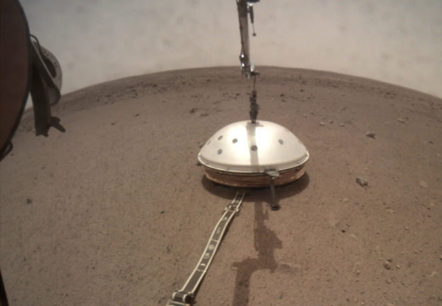
Seismic instruments record more than earthquakes: they also capture avalanches, landslides, impacts, atmospheric activity, and ice cracking. I use these signals to detect active surface processes, reconstruct their timing and dynamics, and evaluate what future planetary seismometers may observe.
Current work combines small field networks, waveform and polarization analysis, source-force modeling, scattering transforms, and machine learning. It builds on experience from NASA's InSight mission and supports preparations for seismic investigations of the Moon, Titan, and other icy worlds.
- Detection and classification of mass-movement signals
- Source reconstruction from seismic waveforms
- Seismic attenuation and detectability in planetary materials
Planetary surfaces and active landscapes
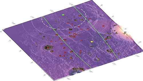
Planetary surfaces preserve evidence of processes that operate under conditions inaccessible on Earth. I analyze dunes, rivers, lakes, avalanches, impact-related changes, and regolith properties to understand how landscapes respond to gravity, climate, volatiles, and surface composition.
My work uses orbital radar and optical imagery, photometry, topography, and mission observations from Mars, Titan, Venus, the Moon, and icy satellites. I am a member of the EuroSAR Science Team for ESA's EnVision mission and contribute to the scientific preparation of radar investigations of Venus.
- Active surface changes and present-day processes
- Radar and photometric properties of planetary regoliths
- Mission-driven geological and geophysical investigations
Remote sensing and sediment transport
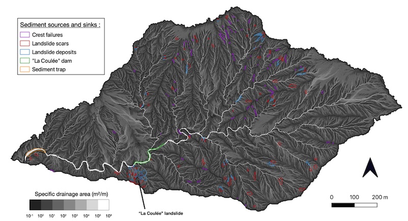
I use optical and radar satellite data, InSAR, photogrammetry, and LiDAR to measure topographic change, surface roughness, deformation, and sediment redistribution. These observations connect event-scale processes to the longer-term evolution of steep catchments and continental surfaces.
Field sites in the Alps, the Mediterranean region, La Réunion, and Guadeloupe provide natural test cases for combining repeated observations with transport models. This work contributes to the STERREO project and to the development of the PHYGRAV Platform.
- Topographic change and sediment budgets
- SAR, InSAR, optical imagery, and LiDAR
- Surface roughness, hydrology, and steep-channel transport
A cross-disciplinary approach
Observe
Satellite missions, field instrumentation, seismic networks, LiDAR, and long-term observatories provide measurements across scales.
Model
Physical models, inverse methods, and statistical surrogates test mechanisms and connect observations to dynamics.
Compare
Comparisons between Earth and other worlds reveal robust process laws while improving hazard models and mission interpretation.
Share
Open datasets, software, reproducible workflows, and community-led publishing make results easier to inspect and reuse.